Discover a great idea
Tube Style Redway Map
- Added: 21/07/15
Overview
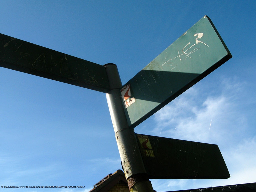
The redways are quite difficult to navigate. Often signs are twisted round and as the weave in and out of estates and industrial areas, it is easy to lose your sense of direction.
Do you want to read more less?
A colour coded map, perhaps London Underground style, that shows some main routes through MK on the redways. Wooden, colour coded posts could mark the routes (nothing that can be twizzled round!) and maps could show cyclists the distances that the routes cover. Each coloured route will have a name (eg yellow route, or central route). Some routes could help cyclists get to MK hubs such as Centre: MK, Bletchley, Newport Pagnell, Stony Stratford etc, and some could perhaps be circular fitness routes.
